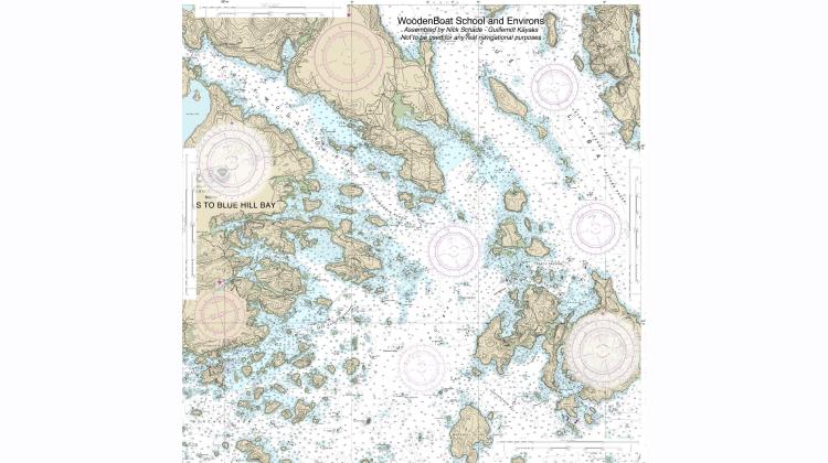
This 24" x 24" waterproof chart is a combination of two NOAA charts that shows the waters around the WoodenBoat School campus. It has a few added compass roses so you don't have to look far to pick out your course. It is printed on a heavy duty polypropylene "paper". Any waterbased pen mark made on the chart will magically become waterproof. It is not possible to erase marks as it will wear the printing off. The polypropylene is foldable but you may lose some ink around the creases.
Note: This chart is created from stitched together digital versions of the old paper charts as published by NOAA with a bit of added information drawn on top. The paper charts are no longer updated to reflect any changes in navigational markers, topological or bathymetric features. This means that this chart is not suitable for consequential navigation. This chart may serve as a learning tool, any use you put it to is done at your own risk.


